


CGI
249 Case Studies
A CGI Case Study
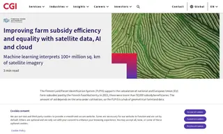
The Finnish Food Authority, responsible for managing national and EU farm subsidies, required a more efficient and equitable system for processing payments to over 50,000 beneficiaries. Their challenge was to accurately monitor vast areas of farmland to determine subsidy amounts, a process that was previously manual and resource-intensive. They partnered with vendor CGI for the development and maintenance of the Finnish Land Parcel Identification System (FLPIS).
CGI implemented a solution leveraging satellite imagery, AI, and cloud computing. Their system uses machine learning to automatically analyze satellite data for over 100 million square kilometers of farmland, monitoring nearly 100% of the surface area. This has enabled comprehensive, automated monitoring, drastically reducing the need for manual field visits. The results include improved equality in the subsidy program, significant cost savings for the Finnish Food Authority, and the creation of valuable data on land conditions and yield potential.
249 Case Studies