


Wingtra
76 Case Studies
A Wingtra Case Study
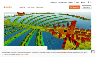
Geotech 3D, a leading surveying firm in Dubai, faced significant challenges with unreliable drones that could not withstand the extreme desert climate, leading to frequent breakdowns, high maintenance costs, and project delays. Their previous systems were prone to damage from sand and required sending drones abroad for repairs, which was both costly and time-consuming. To stay competitive in managing large-scale urban developments and vertical assets, they needed a more robust and high-quality mapping solution from a vendor with reliable local support.
By implementing the WingtraOne drone from Wingtra, Geotech 3D achieved incident-free operations and a dramatic increase in data quality and project speed. The solution's reliability and the exceptional support from Wingtra's local distributor eliminated downtime, resulting in a net gain of $26,240 USD on a single project. For a major 180 km² mapping project, data capture was completed 40% faster than with previous solutions. This performance and the high-resolution outputs have established Geotech 3D as a preferred service provider in Dubai, providing the business stability they needed to grow.
76 Case Studies