


Wingtra
76 Case Studies
A Wingtra Case Study
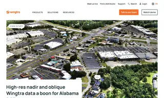
The Alabama Department of Transportation (ALDOT) oversees the state's roadway infrastructure and needed a more efficient drone solution for large-scale mapping projects. Their challenge involved capturing high-accuracy data across long corridors and large areas without flying over people, a task that was too time-consuming with their previous multicopter drones. They turned to Wingtra and its WingtraOne GEN II drone to address this.
Wingtra's solution provided ALDOT with a highly efficient and easy-to-use VTOL drone capable of capturing high-resolution nadir and oblique imagery. This allowed ALDOT to complete massive projects, such as a 75-mile corridor in just 3.5 days, which was previously impossible. The Wingtra system delivered significant time and cost savings, enabling the team to fly over 11,000 acres in under a year and provide taxpayers with greater value.
76 Case Studies