
TerraGo
35 Case Studies
A TerraGo Case Study
AgForce Projects, the state government–funded projects arm of AgForce in Queensland, helps broadacre producers with skills, training and property-based mapping to improve productivity and compliance. The challenge was that farmers must submit detailed GIS maps for vegetation-clearing applications, but most are not GIS-trained and had relied on slow, manual paper mark-ups to show proposed changes.
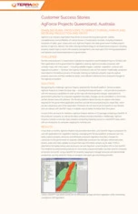
AgForce adopted the TerraGo platform to deliver GeoPDF property maps, accompany them with software and a one-day training option, and enable producers to mark up maps, capture georeferenced notes, photos, audio/video and export required Esri shapefiles — even flagging GPS location. In under 12 months more than 1,200 GeoPDFs were distributed, simplifying government submissions, improving on‑farm resource management, supporting compliance and helping producers better analyze land use for increased production and profit.
35 Case Studies