

Swift Navigation
26 Case Studies
A Swift Navigation Case Study
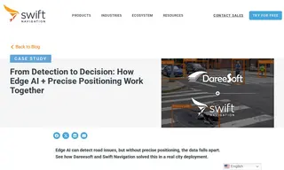
A major U.S. city faced a challenge with its road sign management. The city was working with Swift Navigation and used Dareesoft's Road Analyzer, an edge AI system, to detect damaged or missing signs. However, the solution was hampered by standard GPS, which only provided meter-level accuracy. This caused the same sign to be recorded in different locations on different passes, creating duplicate entries and making it impossible to track changes or reconcile data against existing databases effectively.
By integrating Swift Navigation's Skylark Precise Positioning Service, the solution achieved centimeter-level accuracy. This allowed each AI detection to be anchored to a consistent, real-world location. The result was a system that could deduplicate findings and generate reliable data in real time at the edge. The deployment quickly identified 2,496 signs, flagging 90 as damaged and 20 as missing, proving that fleets of vehicles can now act as continuous mapping systems for maintaining up-to-date infrastructure maps.
Major U.S. City
26 Case Studies