


Spatial Vision
55 Case Studies
A Spatial Vision Case Study
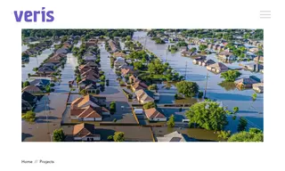
The Climate Council, an independent Australian organization, faced the challenge of communicating the escalating financial and physical risks of climate change to the public and policymakers. They needed a compelling way to visualize how extreme weather events like floods and fires would impact communities under different future emission scenarios. Spatial Vision partnered with them to develop an interactive web application to address this.
Spatial Vision built the Climate Risk Map using Mapbox GL JS, creating a responsive tool that allows users to search any Australian address and see its vulnerability over time. This solution successfully injected climate change into the national media cycle, provided a mechanism for public advocacy, and attracted widespread positive feedback from various sectors. The project effectively communicated the urgent need for emission reductions and was delivered on time and on budget.
55 Case Studies