


Skydio
61 Case Studies
A Skydio Case Study
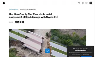
The Hamilton County Sheriff's Office needed to conduct an aerial assessment of severe flood damage to check water levels and property impact, but doing so required sending personnel into hazardous and unstable conditions. They turned to Skydio and its Skydio X10 drone to find a safer solution.
Skydio provided the solution by enabling the sheriff's office to use the Skydio X10 for remote aerial assessment flights. This allowed them to safely monitor changing flood conditions, observe where water was receding, and identify where the river's flow had been redirected into properties. The implementation by Skydio successfully eliminated the need to risk personnel by entering dangerous zones, providing critical situational awareness entirely through remote operations.
61 Case Studies