
Ordnance Survey
213 Case Studies
A Ordnance Survey Case Study
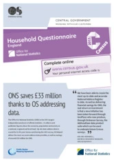
The Office for National Statistics (ONS) needed the most current and accurate address data to run the 2011 Census, improve response rates and meet strict coverage and positional accuracy targets after its 2001 register became outdated. ONS worked with Ordnance Survey (OS), using OS MasterMap Address Layer 2 (AL2), OS MasterMap Topography Layer and pre-build content (later feeding the AddressBase product) to locate households and send census mailings.
Ordnance Survey (OS) helped by text-matching and combining Royal Mail PAF with AL2 and Topography data, then sharing outputs with local authorities and Royal Mail for ground verification; this collaboration also influenced the AddressBase initiative. The solution delivered measurable impact: ONS met under-coverage targets within 1% and 99% positional accuracy, and achieved approximately £33 million in savings (about £25 million in data collection costs plus ~£8 million from no longer maintaining a national address register).
Gee-Mei Redgwell
Address Research Manager
213 Case Studies