
Ordnance Survey
213 Case Studies
A Ordnance Survey Case Study
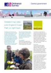
Natural England was tasked with delivering the new England Coast Path—gathering and analysing large volumes of field and third‑party data, running wide public consultations and producing legally secure, standardised maps on a tight budget and timescale. To meet this challenge the CADET project relied on Ordnance Survey data under the Public Sector Mapping Agreement (PSMA) and products such as OS MasterMap Topography Layer, 1:10 000 and 1:25 000 rasters, OS VectorMap Local and OS Net to build the required toolkit.
Ordnance Survey underpinned a customised toolkit of desktop mapping, bespoke GPS data‑capture (Trimble units with ESRI ArcPad forms), a contacts/correspondence database and procedural documentation; captured alignments were processed against OS Net corrections and refined with aerial photography and OS MasterMap. The result was clear, consistent mapping for every section of the proposed trail, significantly improved data sharing with local authorities, smoother public consultation and production of the Coastal Access Report—enabling milestones such as the Weymouth Bay stretch opening in July 2012 and demonstrable improvements in mapping quality and alignment efficiency thanks to Ordnance Survey.
Chris Burstow
GIS Senior Adviser
213 Case Studies