
Ordnance Survey
213 Case Studies
A Ordnance Survey Case Study
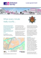
Gloucestershire Fire and Rescue Service faced the challenge of giving crews clear, easy-to-use risk information for over 300 high-risk properties so incidents could be assessed and controlled faster (with potential property loss rates up to £4,200 per minute). Many existing site plans lacked mapping detail, so the service worked with Ordnance Survey using products including OS MasterMap Topography Layer, OS VectorMap Local and scale rasters to improve operational guidance.
Ordnance Survey supplied detailed mapping integrated with CAD plans (exportable to .dxf) and linked these risk cards to Mobile Data Terminals on appliances, so crews can quickly identify hazards, isolation points and firefighter aids. The OS-led solution delivered comprehensive risk cards for every property, sped on-scene assessment, improved decision-making and reduced risk to life and property across Gloucestershire.
Ade Viner
CAD/GIS Survey Technician
213 Case Studies