
Ordnance Survey
213 Case Studies
A Ordnance Survey Case Study
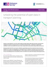
Jacobs, through its transport planning team, needed a faster and more cost-effective way to map and analyze bus networks for local authority clients. Before Ordnance Survey’s OS OpenData and the National Public Transport Data Repository became available, the process was manual, time-consuming, and complicated by multiple data sources and licensing issues.
Ordnance Survey helped Jacobs build Project Solaris using OS OpenData alongside NPTDR and other open datasets to automate multimodal network mapping and accessibility analysis. The solution cut the time needed to analyze the Worcestershire bus network by 90%, while also supporting future transport planning, sustainability testing for developments, and broader use across rail and other transport modes.
Keith Drew
CH2M HILL
213 Case Studies