
Mapbox
217 Case Studies
A Mapbox Case Study
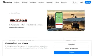
OilTrails, a specialized navigation app for oil and gas field teams, faced significant challenges providing reliable navigation in remote areas with no cellular service. Their initial reliance on Google Maps limited customization, broke the user experience, and even caused an App Store rejection. They needed a robust, customizable mapping solution that could work offline.
By implementing Mapbox's Navigation SDK, Maps, and Directions API, OilTrails built a fully integrated, offline-first navigation system. Mapbox provided superior remote road data and satellite imagery, automatic offline caching, and easy-to-integrate navigation features. This solution allowed OilTrails to create a cohesive, reliable app that has remained the top choice for oilfield navigation for over a decade, helping workers save time and fuel while safely navigating remote job sites.
217 Case Studies